Geolocate

Tonica topographic map

Click on the map to display elevation.

About this map

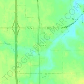
Name: Tonica topographic map, elevation, terrain.

Location: Tonica, LaSalle County, Illinois, United States (41.20495 -89.08698 41.22872 -89.05517)

Average elevation: 669 ft

Minimum elevation: 633 ft

Maximum elevation: 696 ft

LaSalle County trails, hiking, mountain biking, running and outdoor activities

Other topographic maps

Click on a map to view its topography, its elevation and its terrain.

Wedron

United States > Illinois > LaSalle County

Average elevation: 587 ft

Dayton

United States > Illinois > LaSalle County

Average elevation: 587 ft

Hitt

United States > Illinois > LaSalle County > Ottawa

Average elevation: 571 ft

Serena

United States > Illinois > LaSalle County

Average elevation: 630 ft

Gear up for your next adventure:

📖Nature Tracking Books - Learn to track wildlife and terrain
📱Solar Portable Charger - Solar power bank for charging devices off‑grid
🧦Merino Wool Socks - Moisture-wicking, blister-preventing socks for long treks
🛰️Satellite Messengers - Emergency SOS and two-way messaging for off-grid adventures
🦶Carbon Trekking Poles - Reduce knee impact on steep descents with ultra-light poles

As an Amazon Associate, this site earns from qualifying purchases at no extra cost to you.