
Thank you for supporting this site ❤️
Make a donation
Make a donation
Gear up for your next adventure:
As an Amazon Associate, this site earns from qualifying purchases at no extra cost to you.
Argalario topographic map
Click on the map to display elevation.
Thank you for supporting this site ❤️
Make a donation
Make a donation
Gear up for your next adventure:
As an Amazon Associate, this site earns from qualifying purchases at no extra cost to you.
About this map
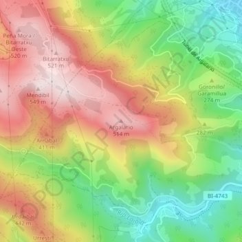
Name: Argalario topographic map, elevation, terrain.
Location: Argalario, Baracaldo, Vizcaya, País Vasco, 48093, España (43.27347 -3.02446 43.27357 -3.02436)
Average elevation: 899 ft
Minimum elevation: 13 ft
Maximum elevation: 1,791 ft
Thank you for supporting this site ❤️
Make a donation
Make a donation
Gear up for your next adventure:
As an Amazon Associate, this site earns from qualifying purchases at no extra cost to you.