
Thank you for supporting this site ❤️
Make a donation
Make a donation
Gear up for your next adventure:
As an Amazon Associate, this site earns from qualifying purchases at no extra cost to you.
Source des Artigues topographic map
Click on the map to display elevation.
Thank you for supporting this site ❤️
Make a donation
Make a donation
Gear up for your next adventure:
As an Amazon Associate, this site earns from qualifying purchases at no extra cost to you.
About this map
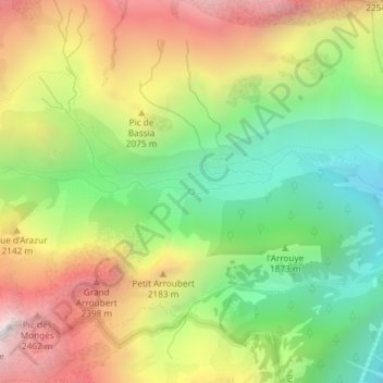
Name: Source des Artigues topographic map, elevation, terrain.
Average elevation: 6,273 ft
Minimum elevation: 4,508 ft
Maximum elevation: 8,445 ft
Thank you for supporting this site ❤️
Make a donation
Make a donation
Gear up for your next adventure:
As an Amazon Associate, this site earns from qualifying purchases at no extra cost to you.
Other topographic maps
Click on a map to view its topography, its elevation and its terrain.
Glacier de Las Néous
France > Occitanie > Hautes-Pyrénées > Arrens-Marsous
Average elevation: 8,527 ft
Refuge du Balaïtous-Ledormeur
France > Occitanie > Hautes-Pyrénées > Arrens-Marsous
Average elevation: 7,067 ft