
Sik topographic map
Click on the map to display elevation.
About this map
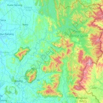
Name: Sik topographic map, elevation, terrain.
Location: Sik, Kedah, Malaysia (5.68391 100.60221 6.28315 101.12794)
Average elevation: 810 ft
Minimum elevation: 10 ft
Maximum elevation: 4,101 ft
Other topographic maps
Click on a map to view its topography, its elevation and its terrain.