
Thank you for supporting this site ❤️
Make a donation
Make a donation
Gear up for your next adventure:
As an Amazon Associate, this site earns from qualifying purchases at no extra cost to you.
Thiza topographic map
Click on the map to display elevation.
Thank you for supporting this site ❤️
Make a donation
Make a donation
Gear up for your next adventure:
As an Amazon Associate, this site earns from qualifying purchases at no extra cost to you.
About this map
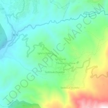
Name: Thiza topographic map, elevation, terrain.
Location: Thiza, Seddouk, Daïra Seddouk, Béjaïa, 06011, Algérie (36.50508 4.68084 36.54508 4.72084)
Average elevation: 1,542 ft
Minimum elevation: 755 ft
Maximum elevation: 3,560 ft
Thank you for supporting this site ❤️
Make a donation
Make a donation
Gear up for your next adventure:
As an Amazon Associate, this site earns from qualifying purchases at no extra cost to you.