Geolocate

Becetto topographic map

Click on the map to display elevation.

About this map
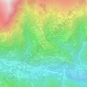
Name: Becetto topographic map, elevation, terrain.

Location: Becetto, Sampeyre, Cuneo, Piemonte, Italia (44.56884 7.18340 44.60884 7.22340)

Average elevation: 4,370 ft

Minimum elevation: 2,710 ft

Maximum elevation: 7,539 ft

Gear up for your next adventure:

🔋Solar Power Banks - Keep your GPS and phone charged in remote wilderness areas
🗺️Topographic Maps - Detailed topo maps for hiking, exploring and outdoor navigation
🧭Orienteering Set - Complete compass and map reading kit
📱Heavy-Duty Phone Cases - Drop-proof and waterproof protection for outdoor navigation
☀️Outdoor Sunscreen - High protection sunscreen for outdoor activities

As an Amazon Associate, this site earns from qualifying purchases at no extra cost to you.