
Make a donation
Gear up for your next adventure:
As an Amazon Associate, this site earns from qualifying purchases at no extra cost to you.
Honghe Hani Rice Terraces topographic map
Click on the map to display elevation.
Make a donation
Gear up for your next adventure:
As an Amazon Associate, this site earns from qualifying purchases at no extra cost to you.
Honghe Hani Rice Terraces
The terraces follow a distinct vertical structure that has allowed the landscape to persist for so long, incorporating forests, villages, terraces, and water supply. At the tops of the mountains (above 2000 meters in elevation), the forests are conserved, to act as a catchment for the rainfall and to "recharge" the fields and terraces below. An intricate system of canals and ditches divert the water into the terraces below. The villages in the region are usually constructed just below the forests, between 1400 and 2000 m. In the World Heritage Site, 82 villages, each with 50-100 households, are protected. The buildings are usually made of adobe and stone. Each household farms one or two terrace plots below, usually growing red rice and breeding cattle.
Make a donation
Gear up for your next adventure:
As an Amazon Associate, this site earns from qualifying purchases at no extra cost to you.
About this map
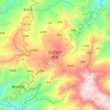
Name: Honghe Hani Rice Terraces topographic map, elevation, terrain.
Average elevation: 5,200 ft
Minimum elevation: 1,834 ft
Maximum elevation: 9,347 ft
Make a donation
Gear up for your next adventure:
As an Amazon Associate, this site earns from qualifying purchases at no extra cost to you.