Geolocate

Elsdorf topographic map

Click on the map to display elevation.

About this map
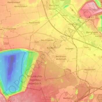
Name: Elsdorf topographic map, elevation, terrain.

Location: Elsdorf, Rhein-Erft-Kreis, North Rhine-Westphalia, 50189, Germany (50.89057 6.47881 50.97639 6.65505)

Average elevation: 217 ft

Minimum elevation: -682 ft

Maximum elevation: 420 ft

Other topographic maps

Click on a map to view its topography, its elevation and its terrain.

Gear up for your next adventure:

🔊Portable Camp Speaker - Music and alerts at camp
📶Satellite Messenger - Communication device off‑grid
📌Outdoor GPS Map App - Apps and devices for digital topographic navigation
🛰️Handheld GPS Units - Professional satellite navigators for precise backcountry mapping
⛺Backpacking Tents - Weight-optimized shelters for multi-day topographic surveys

As an Amazon Associate, this site earns from qualifying purchases at no extra cost to you.