
Make a donation
Gear up for your next adventure:
As an Amazon Associate, this site earns from qualifying purchases at no extra cost to you.
Borovets topographic map
Click on the map to display elevation.
Make a donation
Gear up for your next adventure:
As an Amazon Associate, this site earns from qualifying purchases at no extra cost to you.
Borovets
Borovets (Bulgarian: Боровец [ˈbɔrovɛt͡s]), known as Chamkoria (Чамкория [ˈt͡ʃam koˈrijɐ]) until the middle of the 20th century, is a popular Bulgarian mountain resort situated in Sofia Province, on the northern slopes of Rila mountain, at an elevation of 1350 m.
Make a donation
Gear up for your next adventure:
As an Amazon Associate, this site earns from qualifying purchases at no extra cost to you.
About this map
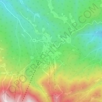
Name: Borovets topographic map, elevation, terrain.
Location: Borovets, Samokov, Sofia, 2010, Bulgaria (42.24683 23.58743 42.28683 23.62743)
Average elevation: 4,573 ft
Minimum elevation: 3,622 ft
Maximum elevation: 6,135 ft
Make a donation
Gear up for your next adventure:
As an Amazon Associate, this site earns from qualifying purchases at no extra cost to you.