
Thank you for supporting this site ❤️
Make a donation
Make a donation
Gear up for your next adventure:
As an Amazon Associate, this site earns from qualifying purchases at no extra cost to you.
Kangbé topographic map
Click on the map to display elevation.
Thank you for supporting this site ❤️
Make a donation
Make a donation
Gear up for your next adventure:
As an Amazon Associate, this site earns from qualifying purchases at no extra cost to you.
About this map
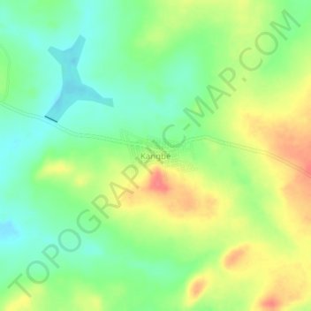
Name: Kangbé topographic map, elevation, terrain.
Location: Kangbé, Savanes, Côte d'Ivoire (9.88000 -5.79529 9.92000 -5.75529)
Average elevation: 1,135 ft
Minimum elevation: 1,050 ft
Maximum elevation: 1,247 ft
Thank you for supporting this site ❤️
Make a donation
Make a donation
Gear up for your next adventure:
As an Amazon Associate, this site earns from qualifying purchases at no extra cost to you.