Geolocate

Uturu topographic map

Click on the map to display elevation.

About this map

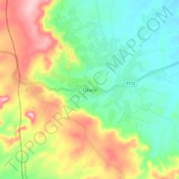
Name: Uturu topographic map, elevation, terrain.

Location: Uturu, Isuikwuato, Abia State, 490101, Nigeria (5.78655 7.38399 5.86655 7.46399)

Average elevation: 558 ft

Minimum elevation: 240 ft

Maximum elevation: 1,089 ft

Gear up for your next adventure:

🧭Orienteering Set - Complete compass and map reading kit
🔥Fast-Boil Camping Stoves - Efficient cooking systems for quick trail meals
🎒Hydration Pack - Hands‑free water reservoir for long hikes
🦺Reflective Outdoor Gear - Safety gear for low‑light conditions
📷Action Camera - Capture your outdoor adventures in HD

As an Amazon Associate, this site earns from qualifying purchases at no extra cost to you.