Geolocate

Nengren topographic map

Click on the map to display elevation.

About this map

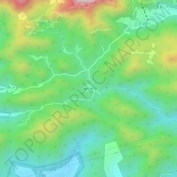
Name: Nengren topographic map, elevation, terrain.

Location: Nengren, Yueqing, Wenzhou, Zhejiang, China (28.32229 121.03585 28.36229 121.07585)

Average elevation: 974 ft

Minimum elevation: 72 ft

Maximum elevation: 2,917 ft

Gear up for your next adventure:

🪶LED Camping Lantern - Bright lantern for camp lighting
🛰️Handheld GPS Units - Professional satellite navigators for precise backcountry mapping
🧭GPS Watch Accessories - Bands and chargers for GPS watches
🧣Merino Neck Gaiters - Multi-functional headwear for wind and sun protection
🪓Survival Multi‑Tool - Versatile tool for camp and trail tasks

As an Amazon Associate, this site earns from qualifying purchases at no extra cost to you.