
Candelaria topographic map
Click on the map to display elevation.
About this map
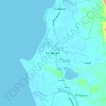
Name: Candelaria topographic map, elevation, terrain.
Location: Candelaria, Zambales, Central Luzon, 2212, Philippines (15.58713 119.89013 15.66713 119.97013)
Average elevation: 30 ft
Minimum elevation: -3 ft
Maximum elevation: 577 ft
Other topographic maps
Click on a map to view its topography, its elevation and its terrain.