Geolocate

Albersbach topographic map

Click on the map to display elevation.

About this map

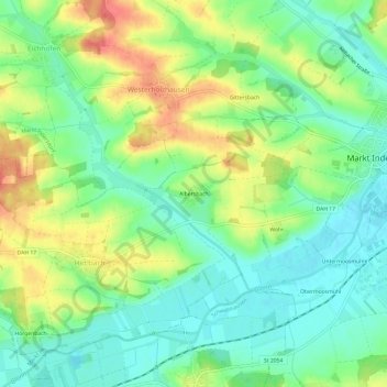
Name: Albersbach topographic map, elevation, terrain.

Location: Albersbach, Westerholzhausen, Markt Indersdorf, Landkreis Dachau, Bayern, 85229, Deutschland (48.33768 11.32531 48.37768 11.36531)

Average elevation: 1,604 ft

Minimum elevation: 1,526 ft

Maximum elevation: 1,719 ft

Other topographic maps

Click on a map to view its topography, its elevation and its terrain.

Gear up for your next adventure:

📱Solar Portable Charger - Solar power bank for charging devices off‑grid
📖Nature Tracking Books - Learn to track wildlife and terrain
📦Dry Bags Set - Waterproof storage for electronics and clothes
🧢Sun Protection Hats - Wide-brimmed and UPF-rated hats for high-altitude sun safety
🥘Titanium Cookware - Durable, featherlight pots and pans for backpacking

As an Amazon Associate, this site earns from qualifying purchases at no extra cost to you.