Geolocate

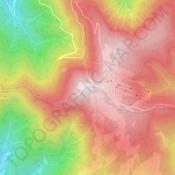
Kandel topographic map

Click on the map to display elevation.

Kandel

De Kandel is een 1241 meter hoge berg, 10,8 km ten oosten van de plaats Waldkirch in de Breisgau, in het Zwarte Woud, in het Duitse Bundesland Baden-Württemberg. Over de berg lopen drie geasfalteerde verkeerswegen naar de pashoogte op 1205 m boven zeeniveau.

Wikipedia (CC-BY-SA 3.0)

About this map

Name: Kandel topographic map, elevation, terrain.

Location: Kandel, Waldkirch, VVG der Stadt Waldkirch, Landkreis Emmendingen, Baden-Württemberg, 79271, Duitsland (48.06248 8.01134 48.06258 8.01144)

Average elevation: 3,228 ft

Minimum elevation: 1,864 ft

Maximum elevation: 4,058 ft

Gear up for your next adventure:

🧷Carabiner Set - Durable clips for gear attachment
🎒Waterproof Dry Bags - Keep your electronics and maps dry inside your pack
🪶LED Camping Lantern - Bright lantern for camp lighting
🌲Outdoor Survival Books - Best books on survival skills
🧭Outdoor Navigation Book - Learn advanced navigation skills

As an Amazon Associate, this site earns from qualifying purchases at no extra cost to you.