
Thank you for supporting this site ❤️
Make a donation
Make a donation
Gear up for your next adventure:
As an Amazon Associate, this site earns from qualifying purchases at no extra cost to you.
Perak River topographic map
Click on the map to display elevation.
Thank you for supporting this site ❤️
Make a donation
Make a donation
Gear up for your next adventure:
As an Amazon Associate, this site earns from qualifying purchases at no extra cost to you.
About this map
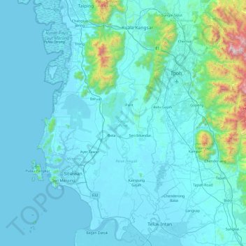
Name: Perak River topographic map, elevation, terrain.
Location: Perak River, Kampung Gajah, Perak Tengah, Perak, Malaysia (3.93872 100.73309 4.87499 101.02835)
Average elevation: 479 ft
Minimum elevation: -23 ft
Maximum elevation: 6,857 ft
Thank you for supporting this site ❤️
Make a donation
Make a donation
Gear up for your next adventure:
As an Amazon Associate, this site earns from qualifying purchases at no extra cost to you.