
Thank you for supporting this site ❤️
Make a donation
Make a donation
Gear up for your next adventure:
As an Amazon Associate, this site earns from qualifying purchases at no extra cost to you.
Montealegre topographic map
Click on the map to display elevation.
Thank you for supporting this site ❤️
Make a donation
Make a donation
Gear up for your next adventure:
As an Amazon Associate, this site earns from qualifying purchases at no extra cost to you.
About this map
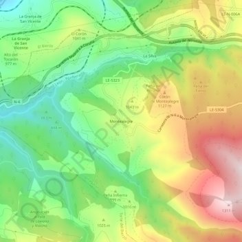
Name: Montealegre topographic map, elevation, terrain.
Location: Montealegre, Villagatón, León, Castile and León, 24379, Spain (42.57205 -6.29230 42.61205 -6.25230)
Average elevation: 3,271 ft
Minimum elevation: 2,484 ft
Maximum elevation: 4,318 ft
Thank you for supporting this site ❤️
Make a donation
Make a donation
Gear up for your next adventure:
As an Amazon Associate, this site earns from qualifying purchases at no extra cost to you.