
Thank you for supporting this site ❤️
Make a donation
Make a donation
Gear up for your next adventure:
As an Amazon Associate, this site earns from qualifying purchases at no extra cost to you.
Bagauda topographic map
Click on the map to display elevation.
Thank you for supporting this site ❤️
Make a donation
Make a donation
Gear up for your next adventure:
As an Amazon Associate, this site earns from qualifying purchases at no extra cost to you.
About this map
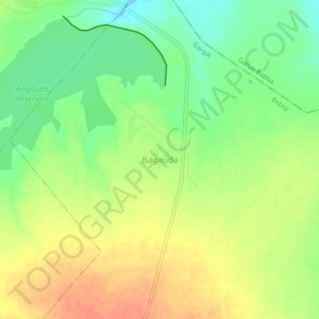
Name: Bagauda topographic map, elevation, terrain.
Location: Bagauda, Gargai, Bebeji, Kano State, Nigeria (11.54960 8.36546 11.58960 8.40546)
Average elevation: 1,634 ft
Minimum elevation: 1,552 ft
Maximum elevation: 1,709 ft
Thank you for supporting this site ❤️
Make a donation
Make a donation
Gear up for your next adventure:
As an Amazon Associate, this site earns from qualifying purchases at no extra cost to you.