Geolocate

Vindrarp topographic map

Click on the map to display elevation.

About this map

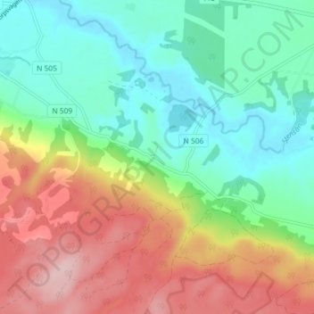
Name: Vindrarp topographic map, elevation, terrain.

Location: Vindrarp, Laholms kommun, Halland County, Sweden (56.38010 13.02820 56.42010 13.06820)

Average elevation: 282 ft

Minimum elevation: 13 ft

Maximum elevation: 715 ft

Other topographic maps

Click on a map to view its topography, its elevation and its terrain.

Hylte kommun

Sweden > Halland County

Average elevation: 476 ft

Vendelsö

Sweden > Halland County

Average elevation: 7 ft

Laholms kommun

Sweden > Halland County

Average elevation: 322 ft

Gällarpesjön

Sweden > Halland County

Average elevation: 341 ft

Halmstads kommun

Sweden > Halland County

Average elevation: 213 ft

Bocksjö

Sweden > Halland County

Average elevation: 246 ft

Kungsbacka kommun

Sweden > Halland County

Average elevation: 135 ft

Tjolöholms slott

Sweden > Halland County

Average elevation: 10 ft

Varbergs kommun

Sweden > Halland County

Average elevation: 115 ft

Gear up for your next adventure:

🧦Merino Wool Socks - Moisture-wicking, blister-preventing socks for long treks
🎁Geography Themed Gifts - Unique gift ideas for map lovers and geography enthusiasts
🎒Trail Energy Bars - High‑calorie bars for hiking energy
🧭Hiking Compass - Precision compass for reliable navigation in the wilderness
☀️Outdoor Sunscreen - High protection sunscreen for outdoor activities

As an Amazon Associate, this site earns from qualifying purchases at no extra cost to you.