
Make a donation
Gear up for your next adventure:
As an Amazon Associate, this site earns from qualifying purchases at no extra cost to you.
General Daniel Cerri topographic map
Click on the map to display elevation.
Make a donation
Gear up for your next adventure:
As an Amazon Associate, this site earns from qualifying purchases at no extra cost to you.
About this map
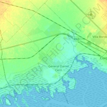
Name: General Daniel Cerri topographic map, elevation, terrain.
Average elevation: 26 ft
Minimum elevation: -3 ft
Maximum elevation: 92 ft
Make a donation
Gear up for your next adventure:
As an Amazon Associate, this site earns from qualifying purchases at no extra cost to you.
Other topographic maps
Click on a map to view its topography, its elevation and its terrain.
Cerro Ceferino
Argentina > Buenos Aires > Cuartel XIII
El Cerro Ceferino, también conocido como Cerro del Amor, es una elevación de 320 m s. n. m. perteneciente al Sistema de Ventania, en la provincia de Buenos Aires, Argentina.
Average elevation: 909 ft
Cerro Ceferino
Argentina > Buenos Aires > Cuartel XIII
El Cerro Ceferino, también conocido como Cerro del Amor, es una elevación de 320 m s. n. m. perteneciente al Sistema de Ventania, en la provincia de Buenos Aires, Argentina.
Average elevation: 909 ft