Geolocate

Mtae topographic map

Click on the map to display elevation.

About this map

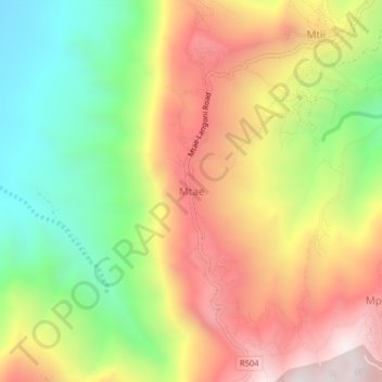
Name: Mtae topographic map, elevation, terrain.

Location: Mtae, Lushoto, Tanga Region, Northern Zone, Tanzania (-4.49694 38.21523 -4.45694 38.25523)

Average elevation: 4,117 ft

Minimum elevation: 2,254 ft

Maximum elevation: 6,076 ft

Other topographic maps

Click on a map to view its topography, its elevation and its terrain.

Handeni

Tanzania > Tanga Region

Average elevation: 1,253 ft

Korogwe

Tanzania > Tanga Region

Average elevation: 2,451 ft

Gear up for your next adventure:

GPS Sports Watch - GPS watch for running, hiking and training
🎒Outdoor Daypacks - Lightweight backpacks designed for carrying maps and essential gear
🧭Map Reading Tools - Tools and kits for map navigation
👟Men's Trail Runners - Lightweight footwear for fast-paced exploration and light hiking
🕶️GPS Smartphone Mount - Secure mount for phone navigation

As an Amazon Associate, this site earns from qualifying purchases at no extra cost to you.