Geolocate

Matinik topographic map

Click on the map to display elevation.

About this map

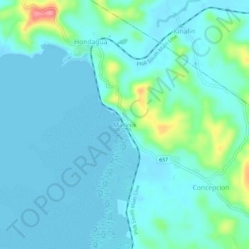
Name: Matinik topographic map, elevation, terrain.

Location: Matinik, Lopez, Quezon, Calabarzon, 4316, Philippines (13.91381 122.22907 13.95381 122.26907)

Average elevation: 52 ft

Minimum elevation: -3 ft

Maximum elevation: 331 ft

Gear up for your next adventure:

📱Heavy-Duty Phone Cases - Drop-proof and waterproof protection for outdoor navigation
🔊Portable Camp Speaker - Music and alerts at camp
👓Polarized Sunglasses - Outdoor sunglasses for glare reduction
🌡️Handheld Weather Meters - Measure wind, temp, and pressure for safe mountain travel
📚Navigation Handbooks - Master the art of reading topographic maps and using a compass

As an Amazon Associate, this site earns from qualifying purchases at no extra cost to you.