Geolocate

Lampay topographic map

Click on the map to display elevation.

About this map

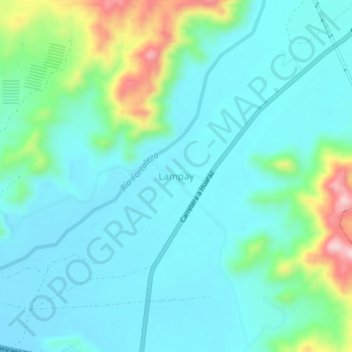
Name: Lampay topographic map, elevation, terrain.

Location: Lampay, Paramonga, Province of Barranca, Lima, 15178, Peru (-10.65947 -77.82381 -10.61947 -77.78381)

Average elevation: 233 ft

Minimum elevation: 49 ft

Maximum elevation: 932 ft

Gear up for your next adventure:

💧Water Filtration Bottles - Safely drink from streams and lakes while exploring
🧥Waterproof Jacket for Hiking - Breathable and rugged rain jacket for outdoor excursions
📻Weather Alert Radios - Stay informed of storm risks while off-the-grid
🎒Day Hiking Backpack - Lightweight backpack perfect for day trips and outdoor adventures
🪶Wildlife Field Guides - Learn animal tracking and species ID

As an Amazon Associate, this site earns from qualifying purchases at no extra cost to you.