Geolocate

Gobabis topographic map

Click on the map to display elevation.

About this map

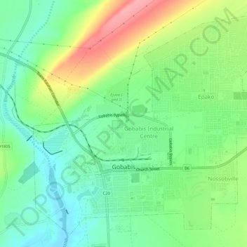
Name: Gobabis topographic map, elevation, terrain.

Location: Gobabis, Omaheke, 11001, Namibia (-22.46279 18.95340 -22.41939 19.00556)

Average elevation: 4,774 ft

Minimum elevation: 4,649 ft

Maximum elevation: 4,993 ft

Other topographic maps

Click on a map to view its topography, its elevation and its terrain.

Ebenhaezer

Namibia > Omaheke

Average elevation: 4,380 ft

Gear up for your next adventure:

🛰️Handheld GPS Units - Professional satellite navigators for precise backcountry mapping
🪶Survival Guide Book - Expert advice for emergency preparedness
🩹Survival Bandages - High‑quality bandages for emergencies
❄️Traction Cleats - Prevent slips on icy trails during winter hikes
🌡️Handheld Weather Meters - Measure wind, temp, and pressure for safe mountain travel

As an Amazon Associate, this site earns from qualifying purchases at no extra cost to you.