
Thank you for supporting this site ❤️
Make a donation
Make a donation
Gear up for your next adventure:
As an Amazon Associate, this site earns from qualifying purchases at no extra cost to you.
Alva topographic map
Click on the map to display elevation.
Thank you for supporting this site ❤️
Make a donation
Make a donation
Gear up for your next adventure:
As an Amazon Associate, this site earns from qualifying purchases at no extra cost to you.
About this map
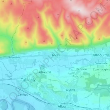
Name: Alva topographic map, elevation, terrain.
Location: Alva, Clackmannanshire, Scotland, FK12 5EG, United Kingdom (56.11303 -3.84112 56.19303 -3.76112)
Average elevation: 673 ft
Minimum elevation: -3 ft
Maximum elevation: 2,359 ft
Thank you for supporting this site ❤️
Make a donation
Make a donation
Gear up for your next adventure:
As an Amazon Associate, this site earns from qualifying purchases at no extra cost to you.