

Udupi topographic map
Click on the map to display elevation.
Udupi
Udupi has an elevation of 27 m (89 ft) above mean sea level. The climate in Udupi is hot in summers and pleasant in winter. During summers (from March to May) the temperature reaches up to 38 °C (100 °F) and in winters (from December to February) it is usually between 32 and 20 °C (90 and 68 °F). As it is a coastal area, there are a few beaches which are tourist attractions. Kaup beach, Malpe beach are two of the beaches in Udupi.
About this map
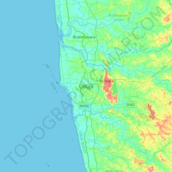
Name: Udupi topographic map, elevation, terrain.
Location: Udupi, Udupi taluku, Udupi, Karnataka, 576101, India (13.18192 74.58732 13.50192 74.90732)
Average elevation: 56 ft
Minimum elevation: -13 ft
Maximum elevation: 397 ft