
Thank you for supporting this site ❤️
Make a donation
Make a donation
Gear up for your next adventure:
As an Amazon Associate, this site earns from qualifying purchases at no extra cost to you.
Rancagua topographic map
Click on the map to display elevation.
Thank you for supporting this site ❤️
Make a donation
Make a donation
Gear up for your next adventure:
As an Amazon Associate, this site earns from qualifying purchases at no extra cost to you.
About this map
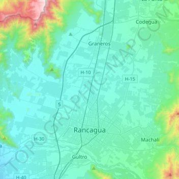
Name: Rancagua topographic map, elevation, terrain.
Location: Rancagua, Provincia de Cachapoal, O'Higgins Region, Chile (-34.21364 -70.94117 -34.02856 -70.67679)
Average elevation: 1,919 ft
Minimum elevation: 1,332 ft
Maximum elevation: 6,033 ft
Thank you for supporting this site ❤️
Make a donation
Make a donation
Gear up for your next adventure:
As an Amazon Associate, this site earns from qualifying purchases at no extra cost to you.