
Shaft topographic map
Click on the map to display elevation.
Shaft
Shaft is a census-designated place (CDP) corresponding to the unincorporated community of Borden Shaft in Allegany County, Maryland, United States. As of the 2010 census, the CDP had a population of 235. It is located south of Frostburg, in the Georges Creek Valley. It lies at an elevation of 1,795 feet (547 m). Borden, or Borden Shaft, was the site of a major deep mine in the valley. The principal owners of the mines were the Borden family of Massachusetts. Deep mines were unusual in the area, as most were drift mines in the Big Vein region. In 1907, the mine operator was H. and W. Hitchens Coal company. The C&P railroad delivered the windlass for the mine, then used its railroad crane to set it in place.
About this map
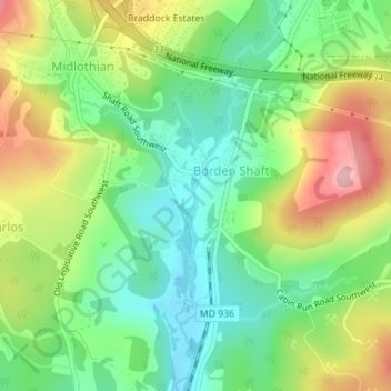
Name: Shaft topographic map, elevation, terrain.
Average elevation: 1,929 ft
Minimum elevation: 1,722 ft
Maximum elevation: 2,241 ft
Allegany County trails, hiking, mountain biking, running and outdoor activities