
Abingdon topographic map
Click on the map to display elevation.
About this map
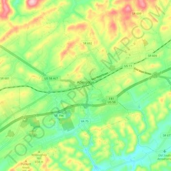
Name: Abingdon topographic map, elevation, terrain.
Location: Abingdon, Washington County, Virginia, United States (36.68571 -82.01961 36.73194 -81.91895)
Average elevation: 2,119 ft
Minimum elevation: 1,844 ft
Maximum elevation: 2,539 ft
Washington County trails, hiking, mountain biking, running and outdoor activities
Other topographic maps
Click on a map to view its topography, its elevation and its terrain.
Clinch Mountain
United States > Virginia > Washington County
For its entire length, Clinch Mountain has only one true gap through which the ridge is completely sliced in half and continues as Clinch Mountain on either side, divided by Big Moccasin Creek. It is named Moccasin Gap and runs between Weber City and Gate City, Virginia. The Norfolk Southern Railway and U.S.…
Average elevation: 2,028 ft