
Thank you for supporting this site ❤️
Make a donation
Make a donation
Gear up for your next adventure:
As an Amazon Associate, this site earns from qualifying purchases at no extra cost to you.
Bumangi topographic map
Click on the map to display elevation.
Thank you for supporting this site ❤️
Make a donation
Make a donation
Gear up for your next adventure:
As an Amazon Associate, this site earns from qualifying purchases at no extra cost to you.
About this map
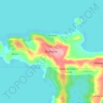
Name: Bumangi topographic map, elevation, terrain.
Location: Bumangi, Mugoye, Bujumba, Kalangala, Central Region, Uganda (-0.35812 32.19699 -0.27812 32.27699)
Average elevation: 3,799 ft
Minimum elevation: 3,701 ft
Maximum elevation: 4,186 ft
Thank you for supporting this site ❤️
Make a donation
Make a donation
Gear up for your next adventure:
As an Amazon Associate, this site earns from qualifying purchases at no extra cost to you.