Geolocate

Antuyo topographic map

Click on the map to display elevation.

About this map

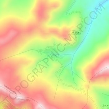
Name: Antuyo topographic map, elevation, terrain.

Location: Antuyo, Tambobamba, Cotabambas, Apurímac, Perú (-14.08258 -72.28177 -14.04258 -72.24177)

Average elevation: 13,533 ft

Minimum elevation: 12,467 ft

Maximum elevation: 14,472 ft

Gear up for your next adventure:

🧭Compass with Lanyard - Easy‑carry compass for navigation
🔌USB Car Charger - Car charger for on‑the‑go power needs
🪑Ultralight Camp Chairs - Portable seating for resting after a long day of mapping
🌡️Portable Weather Meter - Track weather conditions on the trail
🥾Hiking Shoes - Durable and comfortable shoes for trail hiking

As an Amazon Associate, this site earns from qualifying purchases at no extra cost to you.