
Mark topographic map
Click on the map to display elevation.
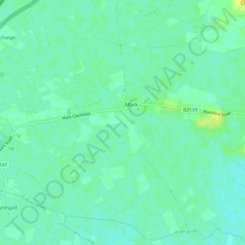
About this map
Name: Mark topographic map, elevation, terrain.
Location: Mark, Somerset, England, United Kingdom (51.19593 -2.93495 51.24963 -2.85775)
Average elevation: 20 ft
Minimum elevation: 0 ft
Maximum elevation: 66 ft
Other topographic maps
Click on a map to view its topography, its elevation and its terrain.
Glastonbury Tor
United Kingdom > England > Somerset > Glastonbury
The Tor is in the middle of the Summerland Meadows, part of the Somerset Levels, rising to an elevation of 518 feet (158 m). The plain is reclaimed fen above which the Tor is clearly visible for miles around. It has been described as an island, but actually sits at the western end of a peninsula washed on…
Average elevation: 108 ft
Midway
United Kingdom > England > Somerset > Mendip District > Stoke St. Michael > Midway
Average elevation: 715 ft
Wales
United Kingdom > England > Somerset > South Somerset > West Camel > Wales
Average elevation: 112 ft
St. Michael's Tower
United Kingdom > England > Somerset > Mendip District > Glastonbury
Average elevation: 108 ft
Friarn
United Kingdom > England > Somerset > Sedgemoor > Nether Stowey > Friarn
Average elevation: 584 ft
Chard
United Kingdom > England > Somerset
Chard is a town and a civil parish in the English county of Somerset. It lies on the A30 road near the Devon and Dorset borders, 15 miles (24 km) south west of Yeovil. The parish has a population of approximately 13,000 and, at an elevation of 121 metres (397 ft), Chard is the southernmost and one of the…
Average elevation: 443 ft
Pleamore Cross
United Kingdom > England > Somerset > Somerset West and Taunton > Rockwell Green > Pleamore Cross
Average elevation: 410 ft
Spring Gardens
United Kingdom > England > Somerset > Mendip > Spring Gardens
Average elevation: 289 ft
Small Brook
United Kingdom > England > Somerset > South Somerset > Haselbury Plucknett
Average elevation: 157 ft
Woodhouse
United Kingdom > England > Somerset > South Somerset > Rimpton > Woodhouse
Average elevation: 243 ft
Durleigh
United Kingdom > England > Somerset > Sedgemoor > Bridgwater > Durleigh
Average elevation: 79 ft