Geolocate

Kessel topographic map

Click on the map to display elevation.

About this map

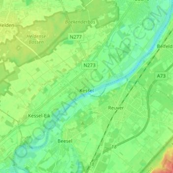
Name: Kessel topographic map, elevation, terrain.

Location: Kessel, Peel en Maas, Limburg, Netherlands (51.26576 5.98668 51.32036 6.10933)

Average elevation: 89 ft

Minimum elevation: 30 ft

Maximum elevation: 203 ft

Other topographic maps

Click on a map to view its topography, its elevation and its terrain.

Mariapeel

Netherlands > Limburg > Evertsoord

Average elevation: 105 ft

Heierhoeven

Netherlands > Limburg > Venlo

Average elevation: 89 ft

Cottessen

Netherlands > Limburg > Vijlen

Average elevation: 600 ft

Overheek

Netherlands > Limburg > Termaar

Average elevation: 387 ft

Horick

Netherlands > Limburg > Ospel > Horick

Average elevation: 105 ft

Schimmert

Netherlands > Limburg > Schimmert > Schimmert

Average elevation: 410 ft

Hout-Blerick

Netherlands > Limburg > Venlo

Average elevation: 72 ft

Gear up for your next adventure:

🪓Survival Multi‑Tool - Versatile tool for camp and trail tasks
🔦Powerful Headlamps - Ultra-bright hands-free lighting for night navigation
🦟Ultrasonic Repellers - Create a bug-free zone at your camp or rest stop
Camping Coffee Makers - Enjoy premium coffee at the summit or campsite
🎒Trail Energy Bars - High‑calorie bars for hiking energy

As an Amazon Associate, this site earns from qualifying purchases at no extra cost to you.