Geolocate

Tambilla topographic map

Click on the map to display elevation.

About this map

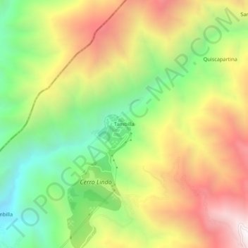
Name: Tambilla topographic map, elevation, terrain.

Location: Tambilla, Chavín, Province of Chincha, Ica, Peru (-13.09741 -76.00911 -13.05741 -75.96911)

Average elevation: 7,260 ft

Minimum elevation: 5,184 ft

Maximum elevation: 9,626 ft

Gear up for your next adventure:

🏔️Mountain Trail Maps - High‑detail maps for popular peaks
😴Insulated Sleeping Pads - Compact and warm pads for high-elevation camping
🚁Photography Drones - Capture stunning aerial views of landforms and topography
🪶Wildlife Field Guides - Learn animal tracking and species ID
🥾Women's Hiking Boots - Top-rated trail boots with ankle support and superior grip

As an Amazon Associate, this site earns from qualifying purchases at no extra cost to you.