
Thank you for supporting this site ❤️
Make a donation
Make a donation
Gear up for your next adventure:
As an Amazon Associate, this site earns from qualifying purchases at no extra cost to you.
Qadi topographic map
Click on the map to display elevation.
Thank you for supporting this site ❤️
Make a donation
Make a donation
Gear up for your next adventure:
As an Amazon Associate, this site earns from qualifying purchases at no extra cost to you.
About this map
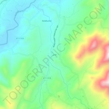
Name: Qadi topographic map, elevation, terrain.
Location: Qadi, Sangi masha, Jaghori, Ghazni Province, Afghanistan (33.05618 67.41618 33.09618 67.45618)
Average elevation: 8,028 ft
Minimum elevation: 7,448 ft
Maximum elevation: 9,380 ft
Thank you for supporting this site ❤️
Make a donation
Make a donation
Gear up for your next adventure:
As an Amazon Associate, this site earns from qualifying purchases at no extra cost to you.