Geolocate

Kuala Perlis topographic map

Click on the map to display elevation.

About this map

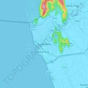
Name: Kuala Perlis topographic map, elevation, terrain.

Location: Kuala Perlis, Perlis, 02000, Malaysia (6.36329 100.09455 6.44329 100.17455)

Average elevation: 33 ft

Minimum elevation: -7 ft

Maximum elevation: 863 ft

Other topographic maps

Click on a map to view its topography, its elevation and its terrain.

Timah Tasoh Reservoir

Malaysia > Perlis

Average elevation: 105 ft

Sungai Batu Pahat

Malaysia > Perlis > Sungai Batu Pahat

Average elevation: 282 ft

View Point Wang Kelian

Malaysia > Perlis

Average elevation: 518 ft

Sungai Tepoh

Malaysia > Perlis > Kangar

Average elevation: 20 ft

Perlis River

Malaysia > Perlis > Kangar

Average elevation: 75 ft

Sungai Kayang

Malaysia > Perlis > Kuala Perlis

Average elevation: 62 ft

Gear up for your next adventure:

🏕️Tent Footprint - Protect your tent base from wear
🕶️Glacier Sunglasses - Side shields to protect eyes from high-altitude snow glare
🪶LED Camping Lantern - Bright lantern for camp lighting
🌎3D Topographic Globes - Raised relief globes for a tactile understanding of geography
🎒Outdoor Daypacks - Lightweight backpacks designed for carrying maps and essential gear

As an Amazon Associate, this site earns from qualifying purchases at no extra cost to you.