
Thank you for supporting this site ❤️
Make a donation
Make a donation
Gear up for your next adventure:
As an Amazon Associate, this site earns from qualifying purchases at no extra cost to you.
Morropon topographic map
Click on the map to display elevation.
Thank you for supporting this site ❤️
Make a donation
Make a donation
Gear up for your next adventure:
As an Amazon Associate, this site earns from qualifying purchases at no extra cost to you.
About this map
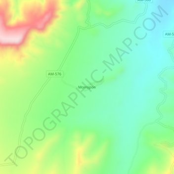
Name: Morropon topographic map, elevation, terrain.
Location: Morropon, Bagua Grande, Utcubamba, Amazonas, Perú (-5.77115 -78.55900 -5.73115 -78.51900)
Average elevation: 1,844 ft
Minimum elevation: 1,490 ft
Maximum elevation: 2,536 ft
Thank you for supporting this site ❤️
Make a donation
Make a donation
Gear up for your next adventure:
As an Amazon Associate, this site earns from qualifying purchases at no extra cost to you.