
Thank you for supporting this site ❤️
Make a donation
Make a donation
Gear up for your next adventure:
As an Amazon Associate, this site earns from qualifying purchases at no extra cost to you.
Pagliari topographic map
Click on the map to display elevation.
Thank you for supporting this site ❤️
Make a donation
Make a donation
Gear up for your next adventure:
As an Amazon Associate, this site earns from qualifying purchases at no extra cost to you.
About this map
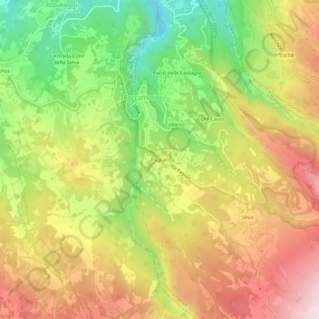
Name: Pagliari topographic map, elevation, terrain.
Location: Pagliari, Roccamorice, Pescara, Abruzzo, Italy (42.18568 14.00744 42.22568 14.04744)
Average elevation: 2,044 ft
Minimum elevation: 1,033 ft
Maximum elevation: 3,022 ft
Thank you for supporting this site ❤️
Make a donation
Make a donation
Gear up for your next adventure:
As an Amazon Associate, this site earns from qualifying purchases at no extra cost to you.