Geolocate

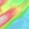
Longeau topographic map

Click on the map to display elevation.

About this map

Name: Longeau topographic map, elevation, terrain.

Location: Longeau, Arrondissement administratif de Bienne, Région administrative du Seeland, Berne, 2543, Suisse (47.16143 7.33812 47.20722 7.39191)

Average elevation: 1,870 ft

Minimum elevation: 1,401 ft

Maximum elevation: 3,924 ft

Other topographic maps

Click on a map to view its topography, its elevation and its terrain.
Gear up for your next adventure:

🧢Sun Protection Hats - Wide-brimmed and UPF-rated hats for high-altitude sun safety
🪶Camp Gear Gift Set - Perfect gift bundle for outdoor fans
🎒Gear Packing Cubes - Organize your backpack efficiently
🔥Fast-Boil Camping Stoves - Efficient cooking systems for quick trail meals
🕶️Glacier Sunglasses - Side shields to protect eyes from high-altitude snow glare

As an Amazon Associate, this site earns from qualifying purchases at no extra cost to you.