Geolocate

Baculin topographic map

Click on the map to display elevation.

About this map

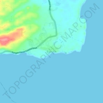
Name: Baculin topographic map, elevation, terrain.

Location: Baculin, Baganga, Davao Oriental, Davao Region, Philippines (7.42895 126.56339 7.46895 126.60339)

Average elevation: 33 ft

Minimum elevation: 0 ft

Maximum elevation: 282 ft

Gear up for your next adventure:

🩳Quick‑Dry Hiking Shorts - Comfortable and quick‑dry shorts for summer hiking
📻Weather Alert Radios - Stay informed of storm risks while off-the-grid
🪶Camping Sleeping Pad - Comfortable sleeping pad for backpacking
🕶️GPS Smartphone Mount - Secure mount for phone navigation
🏫Relief Map Kits - Hands-on tools for teaching landforms and elevation

As an Amazon Associate, this site earns from qualifying purchases at no extra cost to you.