Geolocate

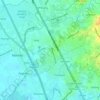
Patubig topographic map

Click on the map to display elevation.

About this map

Name: Patubig topographic map, elevation, terrain.

Location: Patubig, Marilao, Bulacan, Central Luzon, Philippines (14.76712 120.94749 14.78625 120.96656)

Average elevation: 36 ft

Minimum elevation: 13 ft

Maximum elevation: 115 ft

Other topographic maps

Click on a map to view its topography, its elevation and its terrain.
Marilao

Philippines > Bulacan > Marilao

Average elevation: 23 ft

Lias

Philippines > Bulacan > Marilao

Average elevation: 30 ft

Gear up for your next adventure:

🛡️Bear Spray Outdoor - Protection in bear country hikes
🗺️NatGeo Topo Maps - High-quality waterproof printed topographic maps of US Parks
⛑️Personal Locator Beacon - Safety beacon for emergencies
🚪Portable Camp Chair - Foldable chair for comfort at camp
🧼Biodegradable Camping Soap - Eco‑friendly soap for outdoor hygiene

As an Amazon Associate, this site earns from qualifying purchases at no extra cost to you.