Geolocate

Phodong topographic map

Click on the map to display elevation.

About this map
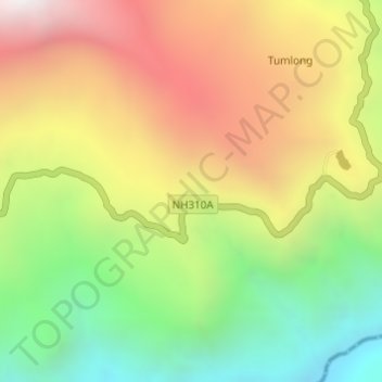
Name: Phodong topographic map, elevation, terrain.

Location: Phodong, Mangan, Sikkim, 737119, India (27.40089 88.56178 27.42089 88.58178)

Average elevation: 5,413 ft

Minimum elevation: 2,956 ft

Maximum elevation: 8,117 ft

Other topographic maps

Click on a map to view its topography, its elevation and its terrain.

Goecha La Lake

India > Sikkim > Mangan

Average elevation: 16,250 ft

Gear up for your next adventure:

🥾Men's Hiking Boots - Durable, waterproof footwear for rugged terrain and steep inclines
⛺Backpacking Tents - Weight-optimized shelters for multi-day topographic surveys
🛰️Satellite Messengers - Emergency SOS and two-way messaging for off-grid adventures
🥾Women's Hiking Boots - Top-rated trail boots with ankle support and superior grip
🎒Hydration Pack - Hands‑free water reservoir for long hikes

As an Amazon Associate, this site earns from qualifying purchases at no extra cost to you.