Geolocate

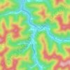
Lobata topographic map

Click on the map to display elevation.

About this map

Name: Lobata topographic map, elevation, terrain.

Location: Lobata, Mingo County, West Virginia, 25691, United States (37.62871 -82.20902 37.66871 -82.16902)

Average elevation: 1,194 ft

Minimum elevation: 643 ft

Maximum elevation: 1,926 ft

Mingo County trails, hiking, mountain biking, running and outdoor activities

Other topographic maps

Click on a map to view its topography, its elevation and its terrain.

Williamson

United States > West Virginia > Mingo County

Average elevation: 1,001 ft

Chattaroy

United States > West Virginia > Mingo County > Chattaroy

Average elevation: 1,161 ft

Justice

United States > West Virginia > Mingo County > Justice

Average elevation: 1,247 ft

Delbarton

United States > West Virginia > Mingo County

Average elevation: 1,237 ft

Williamson

United States > West Virginia > Mingo County

Average elevation: 1,001 ft

Chattaroy

United States > West Virginia > Mingo County > Chattaroy

Average elevation: 1,145 ft

Gear up for your next adventure:

🎒Day Hiking Backpack - Lightweight backpack perfect for day trips and outdoor adventures
🎒Outdoor Daypacks - Lightweight backpacks designed for carrying maps and essential gear
🧦Hiking Socks - Comfortable socks to prevent blisters on long hikes
🔭Telescopic Hiking Pole - Adjustable pole for hiking stability
📖Nature Tracking Books - Learn to track wildlife and terrain

As an Amazon Associate, this site earns from qualifying purchases at no extra cost to you.