Geolocate

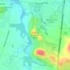
Overall Acres topographic map

Click on the map to display elevation.

About this map

Name: Overall Acres topographic map, elevation, terrain.

Location: Overall Acres, Rutherford County, Middle Tennessee, Tennessee, 37132, United States (35.80562 -86.33499 35.84562 -86.29499)

Average elevation: 663 ft

Minimum elevation: 607 ft

Maximum elevation: 741 ft

Rutherford County trails, hiking, mountain biking, running and outdoor activities

Other topographic maps

Click on a map to view its topography, its elevation and its terrain.
Murfreesboro

United States > Tennessee > Rutherford County

Average elevation: 617 ft

Smyrna

United States > Tennessee > Rutherford County

Average elevation: 577 ft

La Vergne

United States > Tennessee > Rutherford County

Average elevation: 594 ft

Eagleville

United States > Tennessee > Rutherford County

Average elevation: 797 ft

Murfreesboro

United States > Tennessee > Rutherford County

Average elevation: 617 ft

La Vergne

United States > Tennessee > Rutherford County

Average elevation: 594 ft

Murfreesboro

United States > Tennessee > Rutherford County

Average elevation: 617 ft

Gear up for your next adventure:

🛰️Handheld GPS Units - Professional satellite navigators for precise backcountry mapping
📶Vehicle Signal Boosters - Improve reception in rural areas while driving to trailheads
🥾Women's Hiking Boots - Top-rated trail boots with ankle support and superior grip
💧Water Purification System - Clean water on the trail with reliable purifiers
🪶Camping Sleeping Pad - Comfortable sleeping pad for backpacking

As an Amazon Associate, this site earns from qualifying purchases at no extra cost to you.