Geolocate

Niedenstein topographic map

Click on the map to display elevation.

About this map
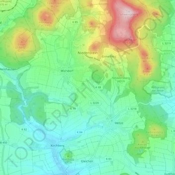
Name: Niedenstein topographic map, elevation, terrain.

Location: Niedenstein, Schwalm-Eder-Kreis, Hesse, 34305, Germany (51.18470 9.26437 51.25409 9.35352)

Average elevation: 965 ft

Minimum elevation: 604 ft

Maximum elevation: 1,834 ft

Other topographic maps

Click on a map to view its topography, its elevation and its terrain.

Schwalmberg

Germany > Hesse > Schwalm-Eder-Kreis > Treysa

Average elevation: 761 ft

Roseberg

Germany > Hesse > Schwalm-Eder-Kreis > Elbersdorf

Average elevation: 1,247 ft

Gear up for your next adventure:

🔌USB Car Charger - Car charger for on‑the‑go power needs
🏥Hiking First Aid Kits - Comprehensive medical kits for remote trail injuries
⛺Backpacking Tents - Weight-optimized shelters for multi-day topographic surveys
📚USA Hiking Guide Books - Top trail guides and map books
🛏️Cold Weather Sleeping Bag - Warm sleeping bag for cold conditions

As an Amazon Associate, this site earns from qualifying purchases at no extra cost to you.