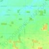
Rawson topographic map
Click on the map to display elevation.
About this map

Name: Rawson topographic map, elevation, terrain.
Location: Rawson, Union Township, Hancock County, Ohio, United States (40.95133 -83.78996 40.96307 -83.77995)
Average elevation: 814 ft
Minimum elevation: 781 ft
Maximum elevation: 827 ft
Hancock County trails, hiking, mountain biking, running and outdoor activities
Other topographic maps
Click on a map to view its topography, its elevation and its terrain.

Findlay
United States > Ohio > Hancock County
Findlay is situated on relatively flat terrain within the northwest region of the state, characterized by gently rolling hills and fertile plains. The city lies at an elevation of approximately 800 feet (244 meters) above sea level, with the Blanchard River meandering through the area, contributing to the…
Average elevation: 797 ft