Geolocate

Tenterden topographic map

Click on the map to display elevation.

About this map
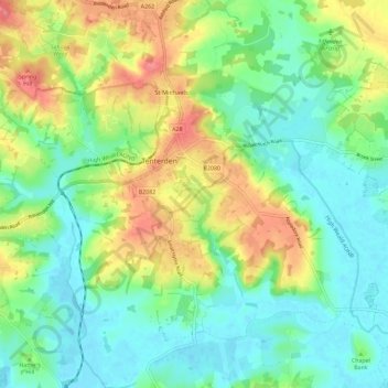
Name: Tenterden topographic map, elevation, terrain.

Location: Tenterden, Ashford, Kent, England, United Kingdom (51.02750 0.64253 51.09999 0.75704)

Average elevation: 92 ft

Minimum elevation: -3 ft

Maximum elevation: 256 ft

Gear up for your next adventure:

🦟Ultrasonic Repellers - Create a bug-free zone at your camp or rest stop
🌄Hiking Binoculars - Compact binoculars for scenic views and trail spotting
🚗GPS Dash Cams - Record your scenic drives through mountain passes and canyons
🪶Camp Gear Gift Set - Perfect gift bundle for outdoor fans
🏕️Family Camping Gear - Essentials for group camping trips

As an Amazon Associate, this site earns from qualifying purchases at no extra cost to you.