
Thank you for supporting this site ❤️
Make a donation
Make a donation
Gear up for your next adventure:
As an Amazon Associate, this site earns from qualifying purchases at no extra cost to you.
Neira topographic map
Click on the map to display elevation.
Thank you for supporting this site ❤️
Make a donation
Make a donation
Gear up for your next adventure:
As an Amazon Associate, this site earns from qualifying purchases at no extra cost to you.
About this map
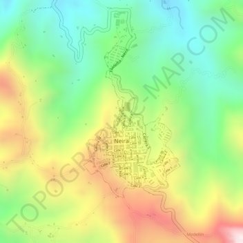
Name: Neira topographic map, elevation, terrain.
Location: Neira, Centrosur, Caldas, 171001, Colombia (5.16110 -75.52524 5.17806 -75.51442)
Average elevation: 6,135 ft
Minimum elevation: 5,282 ft
Maximum elevation: 7,215 ft
Thank you for supporting this site ❤️
Make a donation
Make a donation
Gear up for your next adventure:
As an Amazon Associate, this site earns from qualifying purchases at no extra cost to you.