Geolocate

Mittweida topographic map

Click on the map to display elevation.

About this map

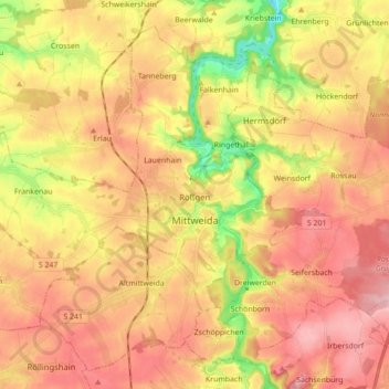
Name: Mittweida topographic map, elevation, terrain.

Location: Mittweida, Mittelsachsen, Saxony, 09648, Germany (50.94498 12.86708 51.04033 13.04153)

Average elevation: 968 ft

Minimum elevation: 640 ft

Maximum elevation: 1,207 ft

Other topographic maps

Click on a map to view its topography, its elevation and its terrain.

Seifersdorf

Germany > Saxony > Mittelsachsen > Hartha

Average elevation: 814 ft

Tuttendorf

Germany > Saxony > Mittelsachsen

Average elevation: 1,234 ft

Dittmannsdorf

Germany > Saxony > Mittelsachsen > Penig

Average elevation: 820 ft

Erdmannsdorf

Germany > Saxony > Mittelsachsen > Augustusburg

Average elevation: 1,234 ft

Hühnerberg

Germany > Saxony > Mittelsachsen > Leisnig

Average elevation: 686 ft

Gear up for your next adventure:

🩳Quick‑Dry Hiking Shorts - Comfortable and quick‑dry shorts for summer hiking
Camping Coffee Makers - Enjoy premium coffee at the summit or campsite
🪶Camp Gear Gift Set - Perfect gift bundle for outdoor fans
🗺️NatGeo Topo Maps - High-quality waterproof printed topographic maps of US Parks
🔦Powerful Headlamps - Ultra-bright hands-free lighting for night navigation

As an Amazon Associate, this site earns from qualifying purchases at no extra cost to you.