
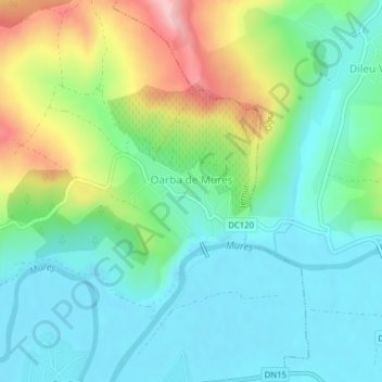
Oarba de Mureș topographic map
Interactive map
Click on the map to display elevation.
About this map
Name: Oarba de Mureș topographic map, elevation, terrain.
Location: Oarba de Mureș, Iernut, Mureș, 545104, Romania (46.45934 24.28346 46.46551 24.29676)
Average elevation: 1,086 ft
Minimum elevation: 912 ft
Maximum elevation: 1,496 ft
Other topographic maps
Click on a map to view its topography, its elevation and its terrain.